 365
365
Cabañeros: El Chorro and Rocigalgo
Toledo
Route of the Chorro and Rocigalgo (Los Navalucillos)
Route of the Chorro and Rocigalgo (Los Navalucillos)
Route of the Chorro and Rocigalgo (Los Navalucillos)
Route of the Chorro and Rocigalgo (Los Navalucillos)

Route of the Chorro and Rocigalgo (Los Navalucillos)
Route of the Chorro and Rocigalgo (Los Navalucillos)

Route of the Chorro and Rocigalgo (Los Navalucillos)

Route of the Chorro and Rocigalgo (Los Navalucillos)

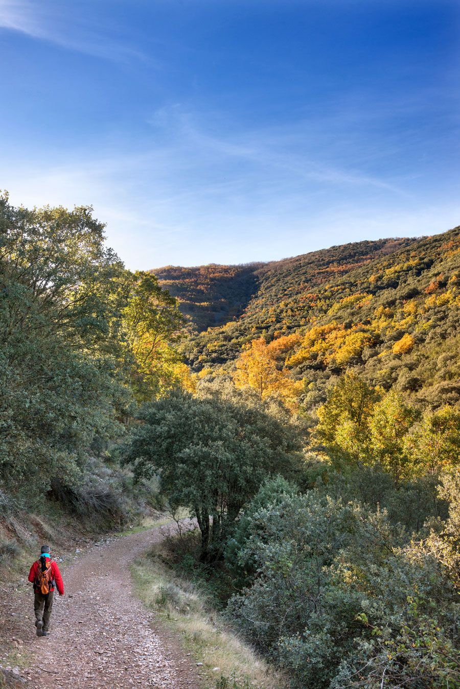
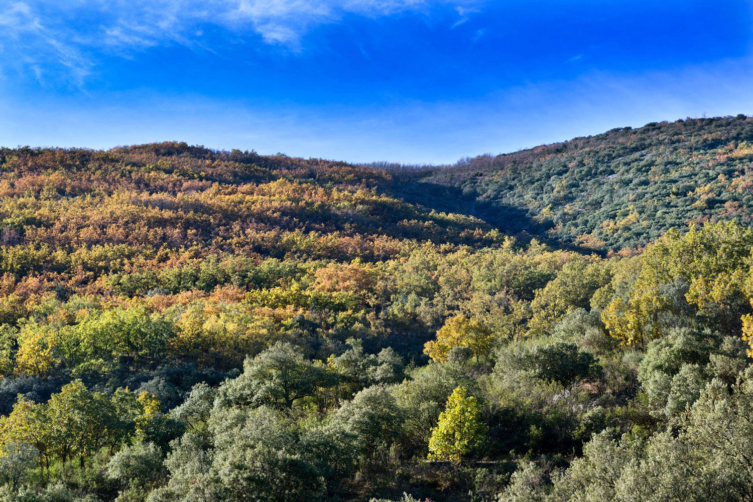


Cabañeros is one of Europe’s most important environmental treasures, a unique stronghold in the Mediterranean forest and a must for nature lovers. And in the heart of this National Park, which almost became a shooting range from the Air Force, the path takes us to el Chorro, one of the jewels of this enclave, and the Rocigalgo peak, one of the highest in the Toledo mountain range at 1,448 metres.
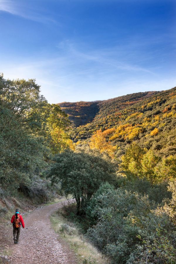
From Toledo, we travel southwest along the CM-401 road. After passing Navahermosa, we reach los Navalmorales and later Los Navalucillos. This is rich olive oil territory, and a popular spot for game meat gastronomy.
The road winds through beautiful scenery and near kilometre 16 of Highway CM-4155, there is an exit towards las Becerras. As a taster for what’s to come, this point offers a lookout with stunning views of Cabañeros. We cross the Pusa river along a dirt track, leave behind a picnic area to the right (we can return later for a well-deserved snack) and reach the information booth next to the National Park boundary, where we get out of our cards and start hiking.
The distances from the Park booth are:
- 4 km to Chorro
- 5.5 km to Chorrera Chica
- 9 km to the Rocigalgo peak
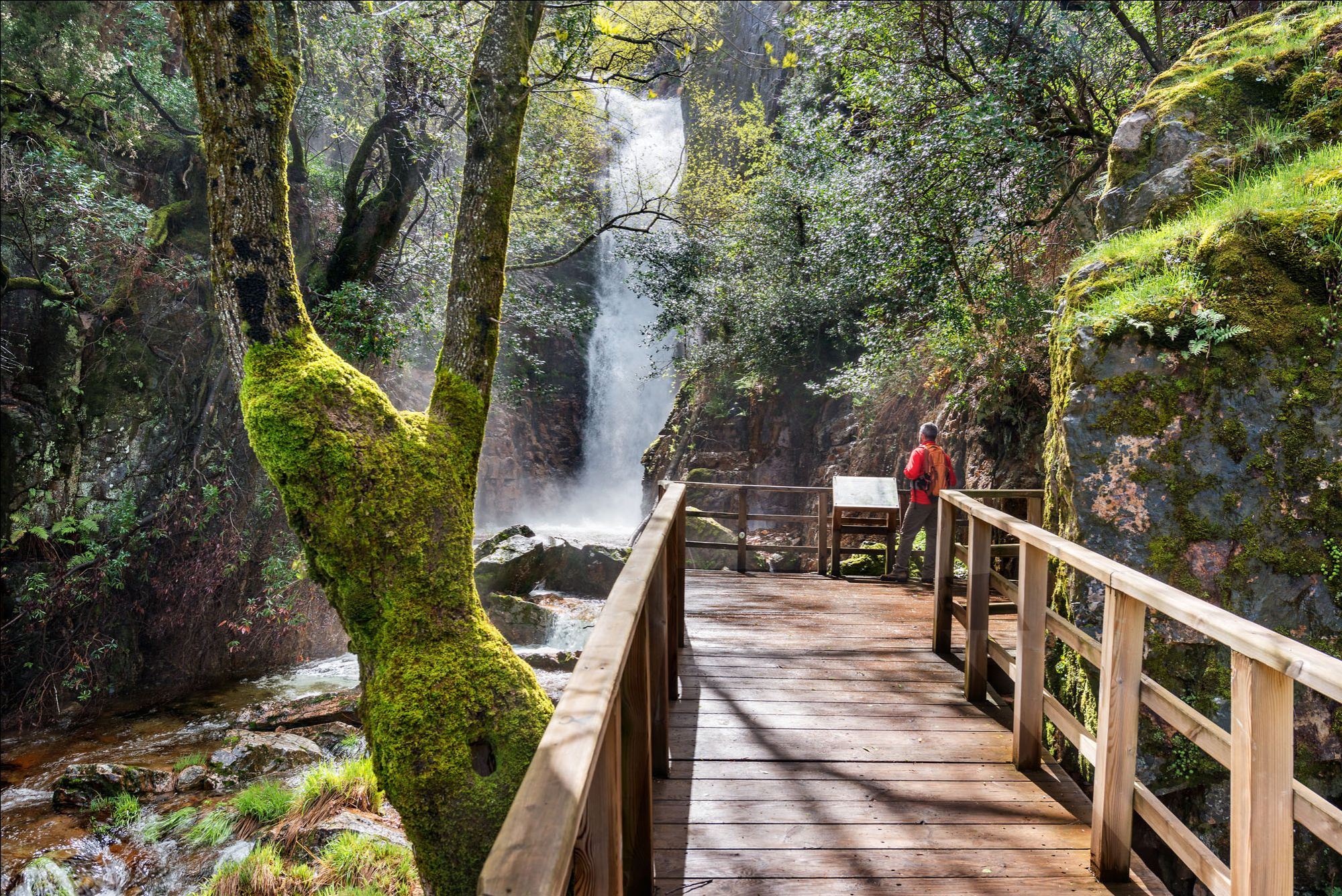
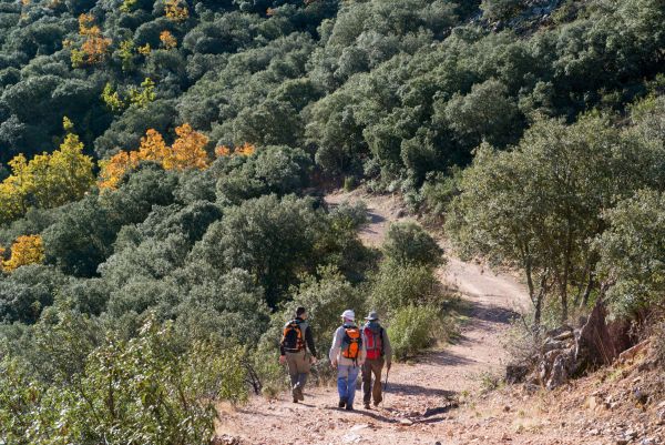
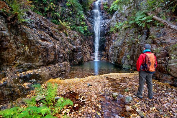
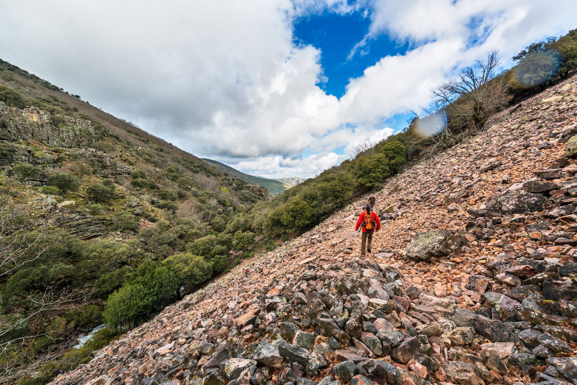
Equipped with good footwear, water and some snacks, we start our journey to the Chorro waterfall. First along a track and then a smaller path, we go through the highest mountainous areas of the National Park. We hike past heather, rockrose and holm oaks. The route crosses the Chorro stream twice and the environment becomes steadily fresher with riverbank vegetation featuring holly, chestnut and yews. The narrow path enters rebollo oak forests that lead, after just under an hour and a half of hiking, to the beautiful, 18-metre high waterfall. We’re in a magical place, with blackbird song in the background and the trickling stream.
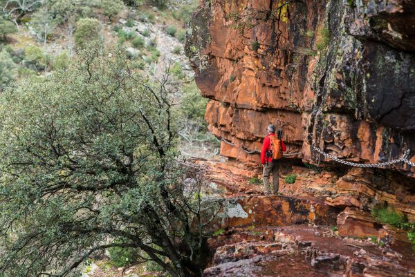
We return along the same way, although for the more daring, the path continues to gain height and then crosses, with the help of some chains that are particularly useful if it’s wet, a rocky stretch to reach the Chorrera Chica (small waterfall). You’ll have no problem spotting birds of prey or griffon vultures, which are very common in the Cabañeros skies, and with a bit of luck, come across a deer drinking from the stream.
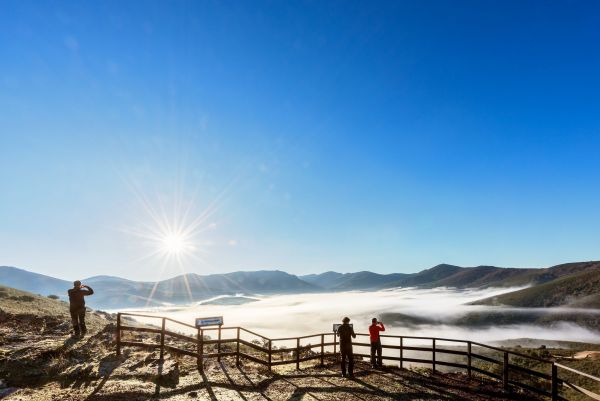
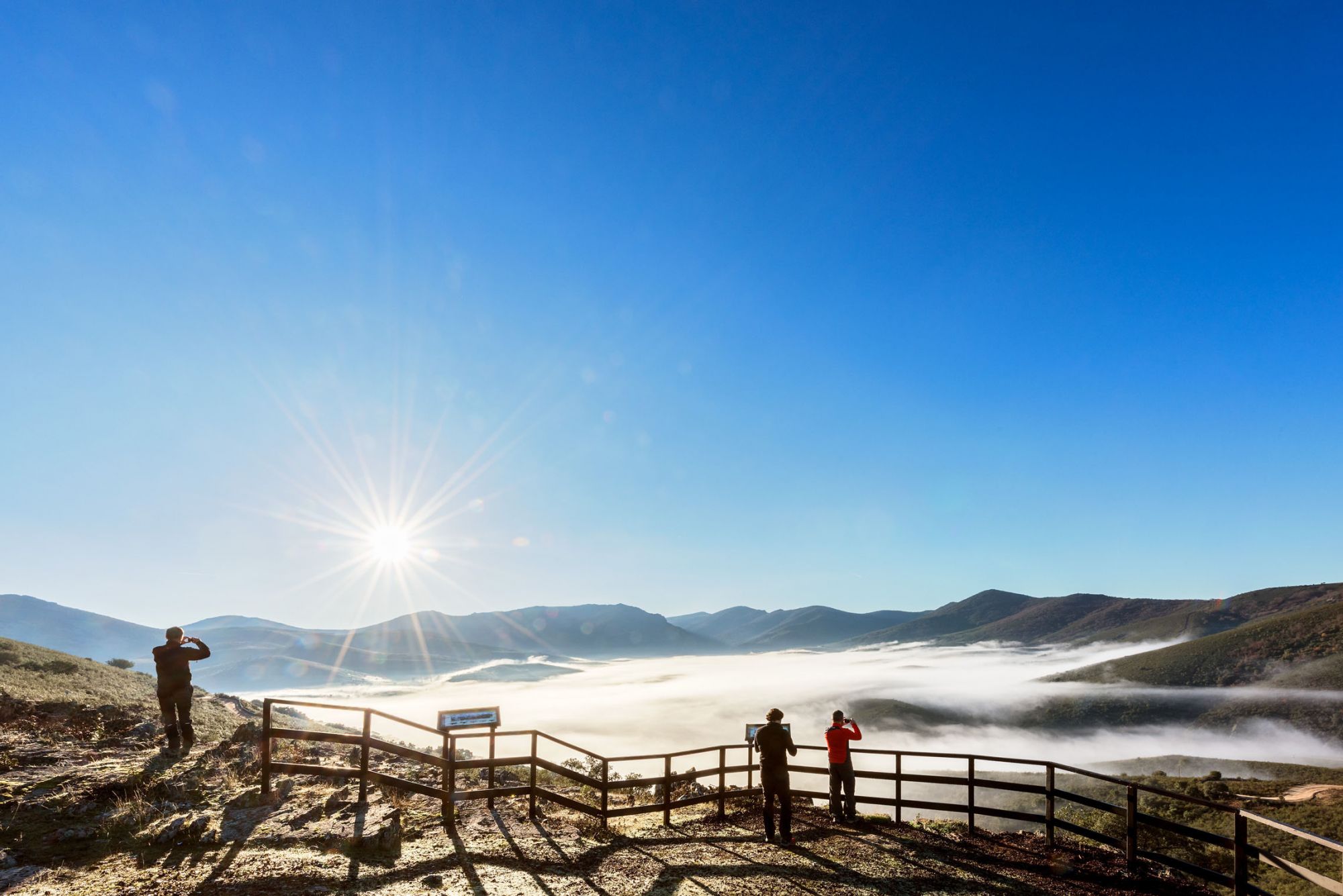
The most impressive part of the route, after almost four hours, takes us to the Rocigalgo peak, the highest point of the Toledo mountain range and offering stunning views over Cabañeros.
A well-earned picnic break at the Pusa river meadows puts the finishing touches on a day to remember.
Any time of the year is good for this trip to the heart of nature, although in late spring you’ll see lusher vegetation and the waterfalls will have more water.
The route can be done independently or with a guide.
May also be of interest to you
Castilla-La Mancha Tourism in 2023. All rights reserved.